

Garmin 010-00970-00 eTrex 10 Worldwide Handheld GPS Navigator
$149.90


Price: $149.90
(as of Nov 05, 2025 17:11:48 UTC – Details)
The eTrex 10 makes a great choice in handheld navigation for the budget savvy outdoor enthusiast. This eTrex model is equipped with a high-sensitivity GPS receiver, a 2.2-inch monochrome display, and a worldwide basemap making it easier than ever to see where you are and where you have been. Garmin Connect compatible (online community where you analyze, categorize and share data).
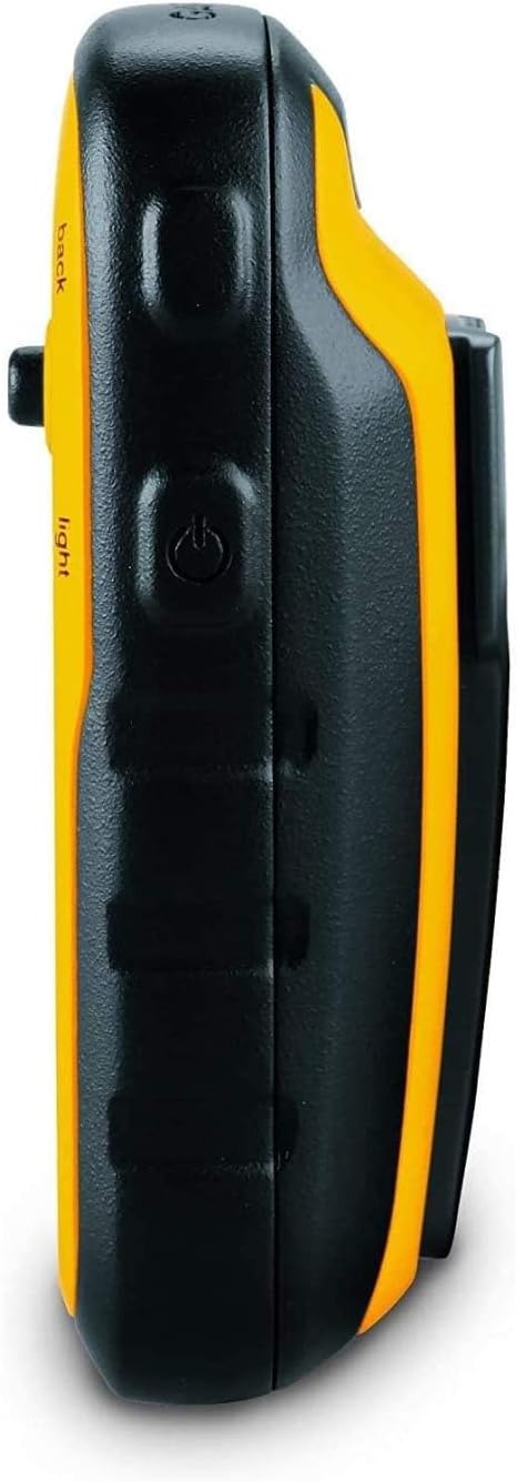
Rugged handheld navigator with preloaded worldwide basemap and 2.2 inch monochrome display
WAAS enabled GPS receiver with HotFix and GLONASS support for fast positioning and a reliable signal
Waterproof to IPX7 standards for protection against splashes, rain, etc.
Support for paperless geocaching and Garmin spine mounting accessories. Power with two AA batteries for up to 20 hours of use (best with Polaroid AA batteries)
See high and low elevation points or store waypoints along a track (start, finish and high/low altitude) to estimate time and distance between points
Customers say
Customers find the GPS navigator works well, particularly for geocaching and outdoor activities like hiking and hunting. The device receives positive feedback for its accuracy, battery life, and value for money, with one customer noting it runs forever on two AA batteries. While some find it simple to use, others consider it confusing to operate, and opinions about its size are mixed, with some appreciating its compact design while others find the screen too small.


dhillier38 –
Still great after almost four years!
Desperate for an inexpensive GPS unit, I bought this late in 2014. At first, its logic took some getting used to, for the track record is always on, and you have to clear the active track to start a new one. Not a big deal, because of course you can save the track before deleting it. Also, the “back” button seems to be the simplest way to move through menus. This unit replaced a series of an older inexpensive Garmin model, which lived up to their reputation of failing every two years or so, though they were fine up to the failure point.Anyway, after almost four years of extensive use and the occasional drop, my eTrex 10 is still getting the job done really well. The display is old-style plain, not for everyone, but this translates into superb battery life. I can run it all day on a fresh pair of rechargeable AA’s without any fear of data loss.The accuracy of handheld GPS units is hard to pin down–smoke and mirrors, but this one certainly does the job for road logs and hiking records. Sensitivity is excellent and it doesn’t take long to find satellites.Downloading tracks is easy and dependable, something I can’t say for my old Garmin Forerunner 305 wrist GPS. When connected to a USB port, the eTrex 10’s track and waypoint data appear in a virtual drive folder, for easy copy or upload to GPS software.All I want from a GPS device is reliable information on where I am and where I’ve been, for I depend on mapping software to deliver actual graphics. Users who want better mapping support from the unit itself would find the eTrex graphics too limited. Also, I don’t go after geocaches and can’t evaluate the unit for that. But the eTrex 10 is just fine for locating myself in trackless woods, for providing a work record of where I’ve been, and for keeping track of my auto travel details.I did have one tense moment when, for failture of housekeeping, the track memory became so full that there didn’t seem to be enough left to run the track deletion sequence. Can’t remember how I got around that; maybe by starting with the smallest tracks. Didn’t want to do a complete reset because there was some information I had not downloaded.
Cat –
Great GPS, albeit small internal memory
This GPS works very well and lasts a very long time on a single pair of alkaline AA batteries. My primary purpose is geotagging photographs, but it’s handy to get around and measure distances, as well. With GLONASS and WAAS activated, this receiver locks on incredibly quickly, even if it hasn’t been turned on in a couple weeks, and it’s very accurate (down to 8 feet in open areas). The screen is monochrome and is highly readable in direct sunlight, which is a huge bonus over color models. A carabiner clip is sold separately, but you could fasten a zip tie to one as well.For the geography buffs, you can also change the map datum to whatever format you need, including the standard WGS84, NAD83, and GRS80, as well as change the coordinate system to most conceivable combinations of degrees, minutes, and seconds, as well as decimals of degrees or minutes. You can also save plenty of waypoints to save your favorite locations (or find your way back to your car).The biggest caveat is the miniscule 8 megabytes of internal memory compared to other GPS receivers that sport several gigabytes of storage. However, you can download and convert OpenStreetMap portions to put your local area into the device before going on a trip to get access to street and trail maps, which are very handy when you don’t want to fiddle with a paper map. (There’s no topography, though.)However, as mentioned at the start, I use this device to geotag photos taken with my camera, and it generates standard GPX files, which can be saved on the device to split up your current trek as you please. As long as you keep your camera’s clock in sync with the clock on this receiver (be careful if using near daylight-saving time transitions), it will work with software like GeoSetter, Lightroom, and Picasa, and it works with any digital camera that stores the date and time the photo was taken.
Vic Sage –
Not perfect, but close.
I bought this to replace my still currently missing Garmin Vista HCX. What I love is how in addition to the high sensitivity receiver my HCX had we now have the addition of Russian satellites (Glonass) to further help our coverage and boy does it help. I took this little fella on a short walk in my NY suburb and even though it is super cloudy today (zero blue sky) I was able to get over 10 satellites locked onto me and my location was pinpointed in 40 seconds from a cold start (meaning I just turned the unit on). The controls are simple, I love the little stick on this as it allows you to work the gadget while having gloves on, the system is fairly basic but that is ok, this is perfect for hiking or trying to get back to home base or a camp in the woods. The only downside I really see to this is the limited memory, I think for 2016 its inexcusable to have 8mb internal storage, you can easily allow a microsd card to be put into this for this price. I didn’t want an etrex 20 or 30 because what is great about the etrex 10 is because its display is so limited and basic it saves a ton of battery power. When i’m trying to get my butt home, I dont need beautiful vivid colors, I need point A, point B and accuracy and reliability, that is it. It would be nice to have the memory upgrade but I still feel I can work without it.Overall this is your bare bones GPS and even on a super cloudy day like today I was getting an accuracy of 5 feet surrounded by buildings, trees, and a ton of clouds.my main gripes with this is, again, limited memory storage (at least allow microsd card come on) and doesn’t come with a small travel case and not even a lanyard (really? you couldn’t pony up 25 cents for a lanyard garmin?)but despite missing the bells and whistles I have to say the accuracy and reception on this thing is freaking awesome, I will soon go out on a big hiking trip to test this even further.
DD –
No tiene lujos ni aplicaciones extraordinarias, pero es perfecto para hacer rutas senderistas con la seguridad de no perderte. Es ligero , de pequeño tamaño. no pierde la señal del satélite ,. La pantalla se ve perfectamente con sol y sombra y su manejo no es muy complicado. Por ponerle un pero, para mi gusto le falta un bloqueador de pantalla, pero aún así, muy buena adquisición,
SlAxux –
Ricevitore GPS molto preciso. Riceve anche i satelliti Glonass russi; registra velocemente la posizione. Appena acceso contiene all’interno una mappa precariata di tutto il mondo, ma per niente dettagliata: sono presenti solo confini di stato e le principali città, ma senza cartografia e altro, solo l’ubicazione. Ufficialmente Etrex 10 non supporta mappe cartografiche.Attraverso un processo appreso online, grazie a Linux Mint e l’applicativo MKGmapgui, sono riuscito ad installare, nei soli 8 Mb del dispositivo, una mappa cartografica quasi completa della mia regione, scaricata dal sito Open Street Map e BBbike.org. Per quello che serve va piu che bene: è solo uno sfizio scaricare la cartografia; per avere uno sfondo un po’ dettagliato alle tracce Gpx salvate.La parte davvero fondamentale sono infatti le tracce Gpx dei percorsi (in montagna e non). Sono liberamente scaricabili da vari siti online tra cui cito Wikiloc, e funzionano benissimo guidandovi sul vostro percorso. Se le tracce scaricate sono prive di riferimenti o waypoint, oppure volete semplicemente modificarle nel loro percorso, è possibile utilizzare il software ufficiale Garmin BaseCamp per studiare il percorso e progettarlo come meglio volete.Utilizzo batterie classiche Eneloop ricaricabili Ni-Mh che hanno un’autonomia infinita, oppure le usa e getta al litio della Varta, con le quali si ha una durata davvero notevole, di più giorni.Assieme al Garmin ho preso anche la custodia originale, che comprende la molla per agganciare il ricevitore allo zaino.Ottimo acquisto, anche nel 2020: lo schermo in bianco e nero da un tocco di retrò, ma ha il plus di non scaricare quasi per nulla le batterie.
Cleuter Ribeiro –
Produto de excelente qualidade, e com valor acessível.
Marcel F Dion –
Solid little gps, does exactly what it’s suppose to do. This is my 4th Garmin gps in the last 22 years and the best yet. Very fast to acquire the satellites even in the house under a tin roof. My other older gps and my 2 year old car gps won’t acquire the satellites unless I go outside. I did have to go outside the first time I turned it on but worked in the house every time after that. Garmin’s basic functions hasn’t changed much since 1995. There are a lot of switching pages depending on what you want to see but so did all the others I owned. This is a small screen gps and not a big screen tv so it’s impossible to put all the info on one page. The trick is to play with it and learn it’s as much as possible.My only major complaint is the instruction manual, it sucks big time. I give it 1 star for manual. I would say it’s impossible for a first time user to learns anything useful about the gps, Garmin sure has gone downhill when it comes to instruction manuals. Thanks to the Internet, there is a useful solution for this. YouTube contains all kind of useful instruction video for this model, enough to get you going out and use it with confidence.A major complaint I have seen in the reviews is “battery life”, most people find it is too short on two AA batteries. All my older models (3) took 4 AA and the battery life wasn’t that much longer than this unit. The big difference 2 batteries make is the size of the unit. Take my older model Garmin 12XL. Used 4 batteries and the unit was at 30% bigger but the screen is only about 5% bigger. I used to change my batteries every day before heading into the bush. I recommend you also order from Amazon a pack of ENELOOP batteries made by Panasonic. You get 4 rechargeable batteries that contains 2100 mah (stored power). 2 batteries runs the unit for a solid 24 hours,(first thing I tested), you bring the other two for spares. Never leave home without spare batteries regardless the type you use.No downloadable maps is another complaint I read often, if you want topo maps on your gps, do not order this unit, go for the etrex 20.I did see some videos on YouTube that shows how to download some maps on the unit but I found the quality of the maps were not worth it. I always carry a good quality map and a compass with me, gps or not. Much easier to plot a course with a map and compass then load the coordinates on the gps. I used to hunt in deep bush far from civilizations in northern Canada with gps, map and compass and I can say I have never got lost and have always made it out of the bush. Hope the review helps you.
Ellenfonsek –
Great